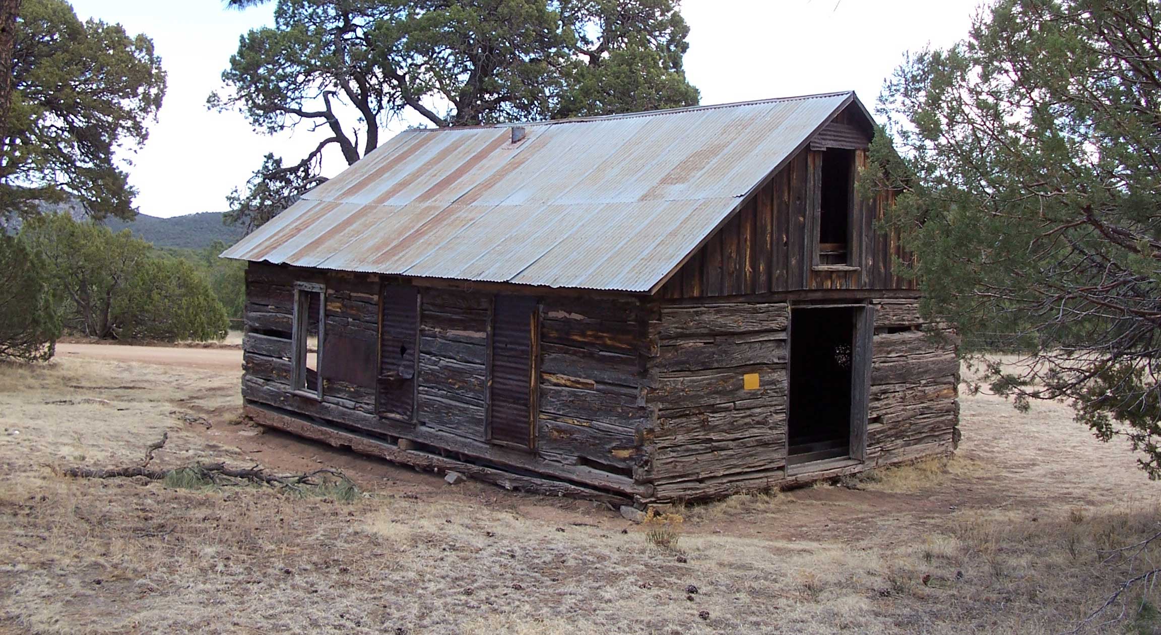
Take a stroll through yesterday with these map packages of the Old West!
These packages have been compiled by R. N. Preston, an avid collector of old maps for more than 40 years. States included are Washington, Oregon, Idaho, and California (divided into two packages at the city of Merced, CA – Northern California and Southern California), Arizona, Utah, New Mexico, Colorado, Nevada and Montana. Imagine 100 years of information compiled and printed on modern USGS maps revealing many secrets!
Ghost Towns and Ghost Sites are yours to rediscover as you peruse and study the maps in this collection. All maps included in the Ghost Town series are reproduced from authentic documents on file from various archival collections such as the National Archives. Each packet, measuring 6.5"x 9.5", contains maps (18" x 24" trimmed) which were selected for quality, age and location details. WHAT MAKES THESE MAPS UNIQUE is the inclusion of a transparent overlay printed from a modern road map. By placing the acetate overlay on top of the corresponding historical map, it quickly becomes apparent that this techniques is a valuable asset in assisting with the location of favorite places. Please be reminded that many early place names that appear may not have been an actual town site. Some early postal services may have been located in a ranch house, stage station or a mining camp. Additionally, some historians have a difference of opinion concerning names and their exact locations. Readers should be reminded of the limitations of the early surveyors who most likely used primitive equipment and limited cartographic knowledge. The compiler wishes to remind the readers of the responsibility of knowing the rules when searching on private, State and Federal lands. Violation of rules is in poor judgment. Good Hunting!
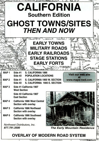
SOUTHERN CALIFORNIA GHOST TOWN MAPS
California (Southern) Ghost Towns/Sites covers the southern portion of the state of California divided at the city of Merced. This ghost town package features a transparent overlay printed from a modern California road system and placed over three sections of the 1886 map of California. The purpose is to show the changes in the state over a period of approximately 100 years. Place names may appear on the historical maps but may be absent on the current map. The reader should note that some of the early locations were moved from time to time while others changed their names or simply failed. The reader should be reminded that some of the early place names might have been a post office operated in a ranch house or an early stage station as well as town sites. Some locations were moved from time to time while others changed their names or simply failed.
Accompanying text with anecdotal stories from the history of each of the four sections of the state appears on the reverse sides of maps #4-6. For example, Coyote Wells in the southeast section as shown on the 1886 map was named by James Mason of the “Jackass Mail Lines.” Evidently the name Coyote Wells was inspired when he saw a coyote scratching the sand for water.
Product Description California (Southern) Ghost Towns/Sites: Then and Now is a package of sixmaps measuring 6.5″ x 9″ of southern California. The state of California has been divided into two packages at the city of Merced. The very readable maps (measuring 18″ x 24″ unfolded) were selected for quality, age and location details. This package includes: Map #1,side 1 S. California 1886. Side 2 Population locations Map #2,side 1 S. California 1900 western section. Side 2 S. California 1900 eastern section Map #3,side 1 California 1907 west section. Side 2 California 1907 east section Map #4,side 1 California 1886 west central section with overlay. Side 2 is text Map #5,side 1 California 1886 northeast section with overlay. Side 2 is text Map #6,side 1 California 1886 southeast section with overlay. Side 2 is text
Description
Order No.
Price
Order Now
Southern California Ghost Town Maps
23-1867
$15.95
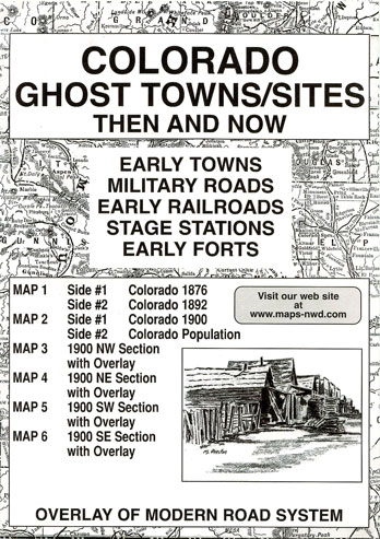
COLORADO GHOST TOWN MAPS
The Colorado Ghost Towns/Sites packages features a transparent overlay printed from a modern Colorado road system and placed over the four sections of the 1900 map of Colorado. The purpose is to show the changes in the state over a period of approximately 100 years. Place names may appear on the historical maps but may be absent on the current map. The reader should note that some of the early locations were moved from time to time while others changed their names or simply failed. The reader should be reminded that some of the early place names might have been a post office operated in a ranch house or an early stage station as well as town sites. Some locations were moved from time to time while others changed their names or simply failed.
Accompanying text with anecdotal stories from the history of each of the four sections of the state appears on the reverse sides of maps #3-6. For example, the site of Tin Cup located in eastern Gunnison County , east of Jack’s Cabin shown on the railroad to Creed on the Colorado 1900 SW section map, was a wild little settlement. it went through eight marshals in a short period of time. Four cemeteries were required to accommodate the demand. one was dubbed the “Boot Division” that was to care for those who died with their boots on.
Product Description Colorado Ghost Towns/Sites: Then and Now is a package measuring 6.5″ x 9″ and contains six maps of the state of Colorado. The very readable maps (measuring 18″ x 24″ unfolded) were selected for quality, age and location details. This package includes: Map #1 ,side 1 Colorado 1876. Side 2 Colorado 1892 Map #2,side 1 Colorado 1900. Side 2 Colorado populations Map #3,side 1 Colorado 1900, northwest section with overlay. Side 2 is text Map #4,side 1 Colorado 1900, northeast section with overlay. Side 2 is text Map #5,side 1 Colorado 1900, southwest section with overlay. Side 2 is text Map #6,side 1 Colorado 1900, southeast section with overlay. Side 2 is text
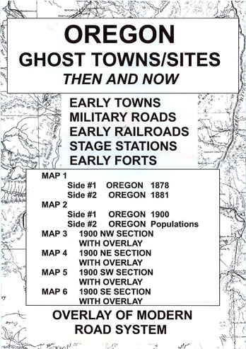
OREGON GHOST TOWN MAPS
The Oregon Ghost Towns/Sites package features a transparent overlay printed from a modern Oregon road system and placed over the four sections of the 1900 map of Oregon. The purpose is to show the changes in the state over a period of approximately 100 years. Place names may appear on the historical maps but may be absent on the current map. The reader should note that some of the early locations were moved from time to time while others changed their names or simply failed. The reader should be reminded that some of the early place names might have been a post office operated in a ranch house or an early stage station as well as town sites. Some locations were moved from time to time while others changed their names or simply failed.
Accompanying text with anecdotal stories from the history of each of the four sections of the state appears on the reverse sides of maps #3-6. For example, located in the NE section of the Oregon 1900, Wallowa County, Leap had established a post office in a ranch house in 1892 — apparently the name was chosen because it was a leap year. Many additional place names appear in the NE section of the state including Bake Oven, Gooseberry, Monkland and Grade. Oftentimes the post office operated for just a few short years as was the case for Clifford (1894-1901) and Flickbar (1897-1899).
Product Description Oregon Ghost Towns/Sites: Then and Now is a package, measuring 6.5″ x 9″, containing six maps of the state of Oregon. The very readable maps (measuring 18″ x 24″ unfolded) were selected for quality, age and location details. This package includes: Map #1, side 1 Oregon 1878. Side 2 Oregon 1881 Map #2,side 1 Oregon 1900. Side 2 Oregon populations Map #3,side 1 Oregon 1900 northwest section with overlay. Side 2 is text Map #4,side 1 Oregon 1900 northeast section with overlay. Side 2 is text Map #5,side 1 Oregon 1900 southwest section with overlay. Side 2 is text Map #6,side 1 Oregon 1900 southeast section with overlay. Side 2 is text
Description
Order No.
Price
Order Now
Oregon Ghost Town Maps
23-1860
$15.95
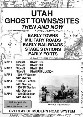
UTAH GHOST TOWN MAPS
The Utah Ghost Towns/Sites package features a transparent overlay printed from a modern Utah road system and placed over the four sections of the 1900 map of Utah. The purpose is to show the changes in the state over a period of approximately 100 years. Place names may appear on the historical maps but may be absent on the current map. The reader should note that some of the early locations were moved from time to time while others changed their names or simply failed. The reader should be reminded that some of the early place names might have been a post office operated in a ranch house or an early stage station as well as town sites. Some locations were moved from time to time while others changed their names or simply failed.
Accompanying text with anecdotal stories from the history of each of the four sections of the state appears on the reverse sides of maps #3-6. For example, the SE section of the state as shown on the 1900 map displayed portions of six counties with San Juan as the largest. Thirty seven town names appear in this area with only 11 reporting inhabitants. In that same section, Hanksville first reported a population in 1900 with a count of 100 souls. It was the settlement that was located nearest to Robbers Roost Country…a place known as a hangout for Butch Cassidy and the wild bunch in the early days. Surrounded by high cliffs and deep canyons with difficult rivers, it afforded a perfect hideout that was never penetrated by the law.
Product Description Utah Ghost Towns/Sites: Then and Now is a package, measuring 6.5″ x 9″, containing six maps of the state of Utah. The very readable maps (measuring 18″ x 24″ unfolded) were selected for quality, age and location details. This package includes: Map #1,side 1 Utah 1876. Side 2 Utah 1889 Map #2, side 1 Utah 1900. Side 2 Utah populations Map #3,side 1 Utah 1900 northwest section with overlay. Side 2 is text Map #4,side 1 Utah 1900 northeast section with overlay. Side 2 is text Map #5,side 1 Utah 1900 southwest section with overlay. Side 2 is text Map #6,side 1 Utah 1900 southeast section with overlay. Side 2 is text